Captured Landscape (2015-2016)
Focusing on historic and contemporary imaging technology, the collaborative project Captured Landscape investigates how Silicon Valley has redefined the limits of "seeing" from the pioneering photographic work of Edward Muybridge to NASA's Airborne Sensor Facility. Captured Landscape was produced by Stephen Cooke, Shona Kitchen, Alyson Ogasian and Claudia O’Steen with the help of Vivian Charlesworth, Yun Hong, and Tim Wang. Many thanks to Bruce Coffland and Josh Forgione of NASA Ames.


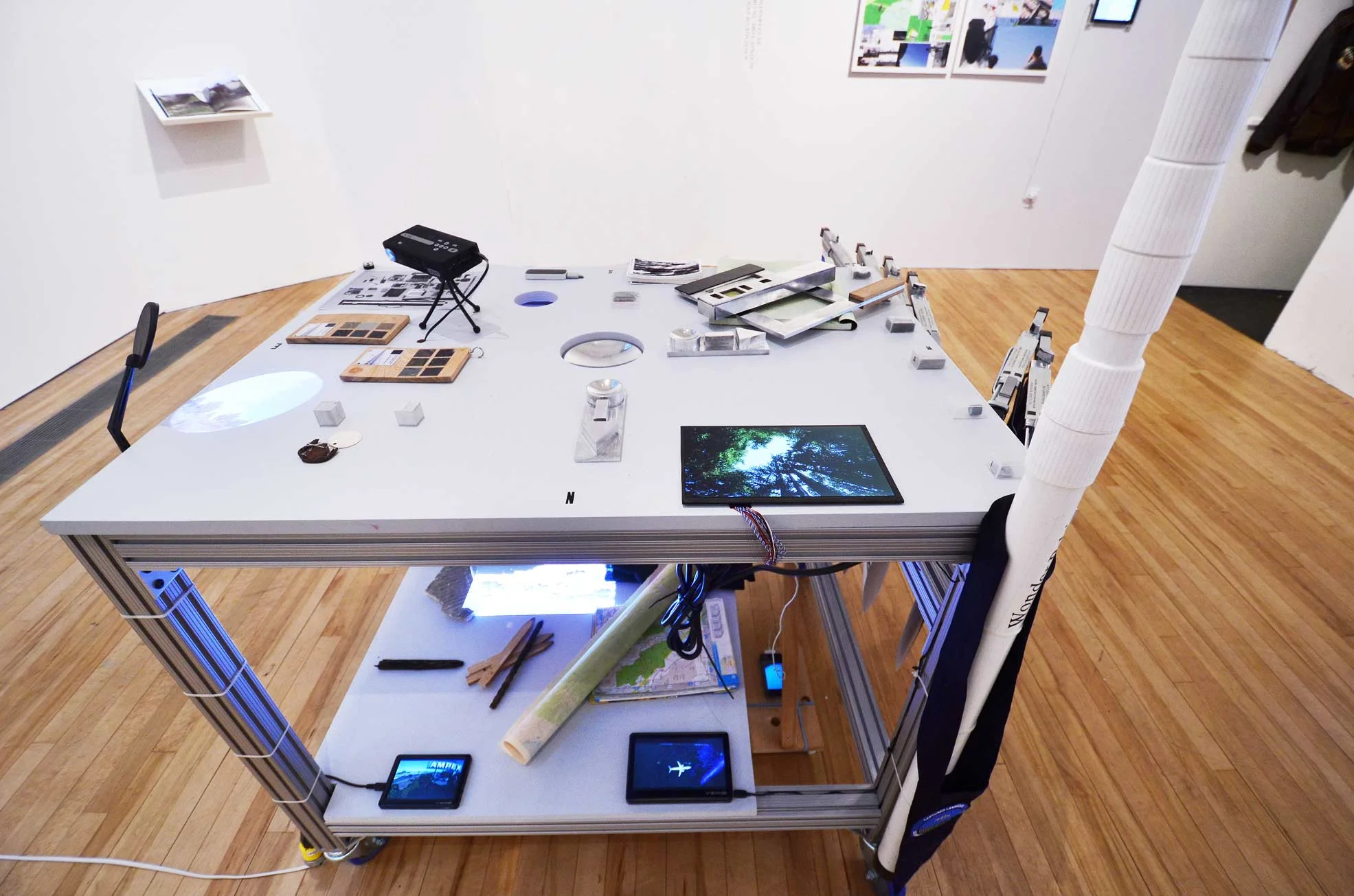

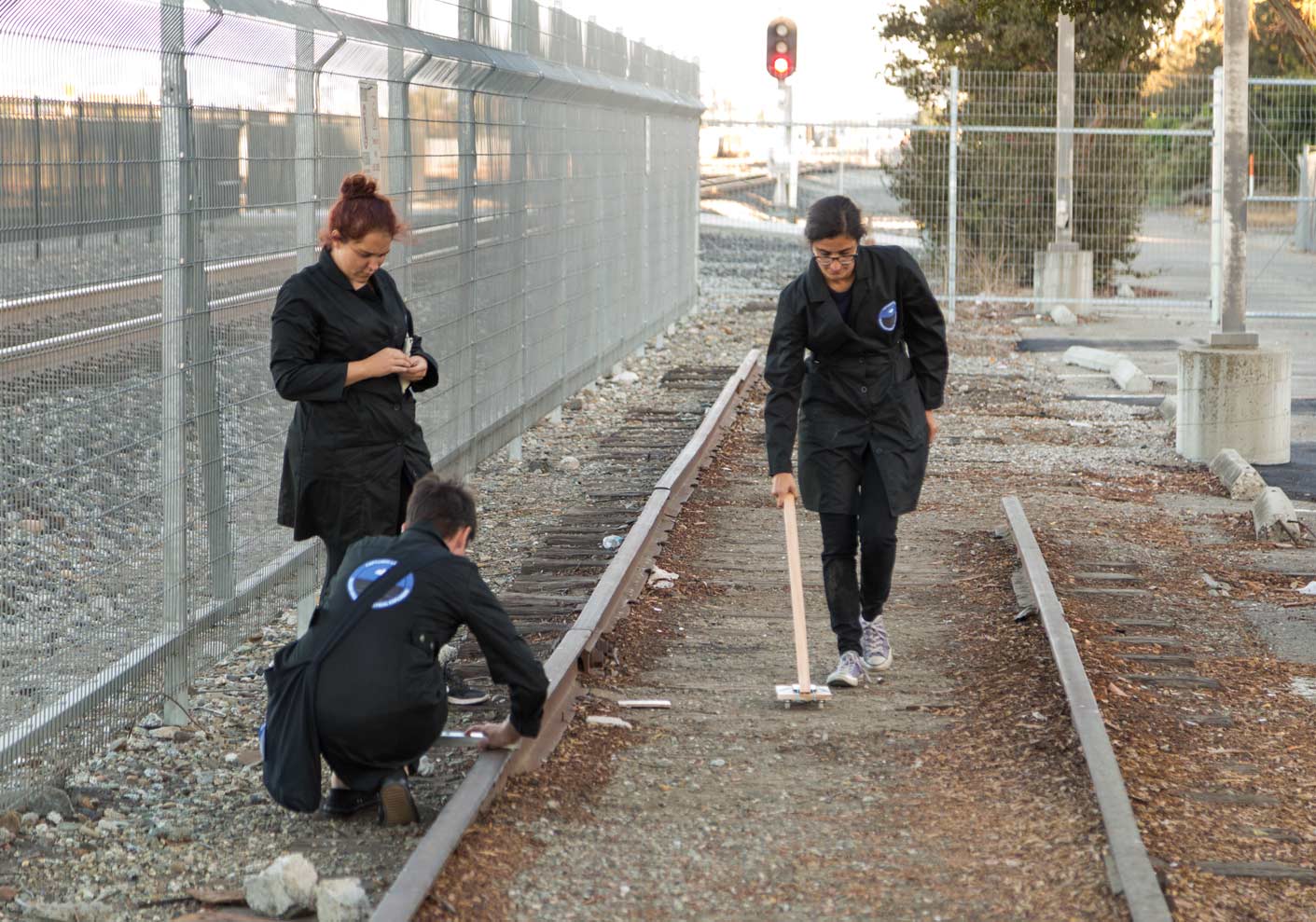
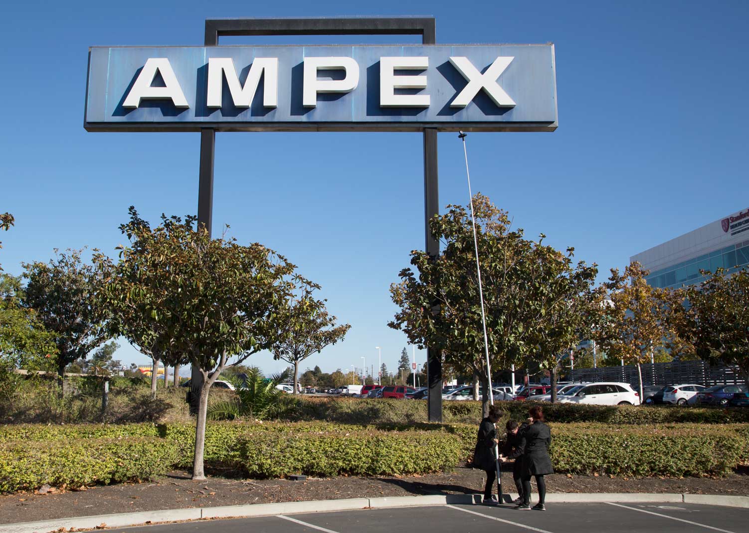
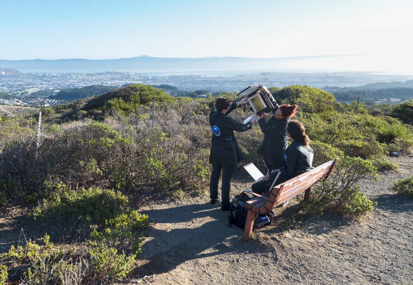
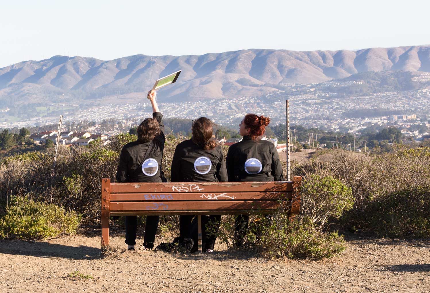
Silicon Valley Terrestrial Explorers' Expedition (Kitchen, Ogasian, O’Steen, Cooke) collected artifacts and findings from sites from west to east in Silicon Valley: Sweeney Ridge (San Francisco Discovery Point), Crystal Dam, Sand Hill Road, Ampex Sign, Muybridge's experimental track, last camp of the Portola Expedition, Federal Telegraph Site, Fairchild Semiconductor Site, Google, Centrillion Biosciences, Lunar Orbiter Recovery Project (McMoon), Airborne Sensor Facility, Site of Onizuka Air Force Station, Santa Clara Station, The Lick Observatory/Mount Hamilton.
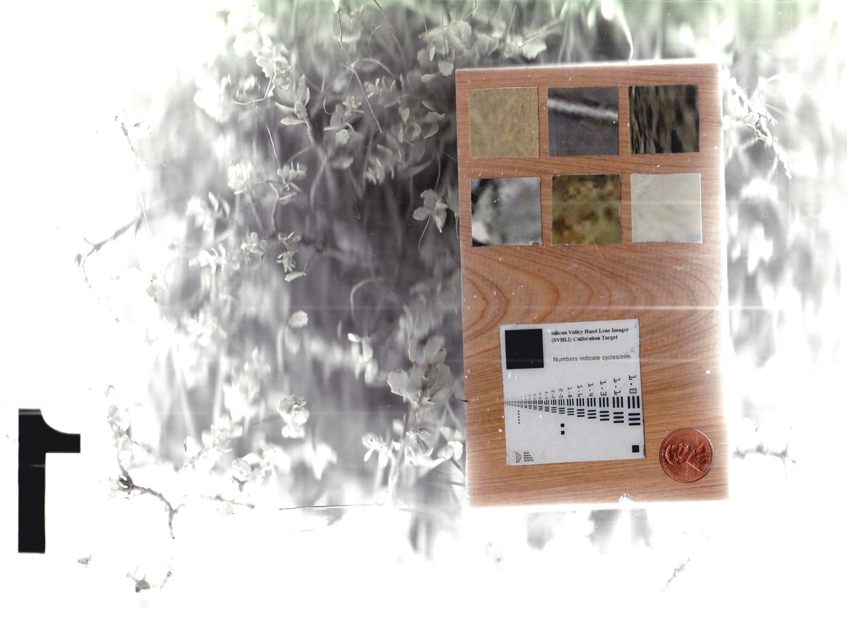
SVTE used a variety of off the shelf and custom tools including the Silicon Valley Hand Lens Imager (SVHDI). Patches of pigmented material on the upper portion of the SVHDI target serve as aids for interpreting color and brightness in images. There are six samples on each side, each one an image taken from Google Earth using the exact coordinates of each of the 12 expedition depots visited along the journey. The target's bar graphic is adapted from a standardized U.S. Air Force chart for testing camera resolution.